Why Lake Shasta Water Levels Matter
At full pool, Lake Shasta can store more than 4.5 million acre-feet of water, making it the largest reservoir in California. That massive capacity plays a vital role in:
Supplying water to Central Valley agriculture
Providing drinking water to millions of Californians
Supporting hydropower generation
Controlling flood risks
Enabling recreational activities like boating and fishing
When Lake Shasta water levels drop too low, the consequences ripple throughout the state—from decreased water allocations to restrictions on recreational access. On the other hand, levels that rise too high during heavy rain seasons can trigger concerns about flooding or dam stress.
What Affects the Water Level in Lake Shasta?
The water level Lake Shasta is influenced by several key factors:
1. Rainfall and Snowpack
The lake relies heavily on rainfall and snowmelt from the Sierra Nevada and Cascade ranges. Snowpack from Mount Shasta and surrounding mountains feeds into rivers and tributaries like the Sacramento, McCloud, and Pit Rivers, which in turn replenish the lake.
2. Seasonal Changes
Spring snowmelt typically causes water levels to rise, peaking between April and June. In contrast, late summer and fall tend to see lower levels due to reduced inflow and increased water usage for irrigation.
3. Water Releases
The lake's outflows are carefully managed by the Bureau of Reclamation. Water is released downstream to meet agricultural needs, environmental commitments, and municipal demands, especially in the drier months.
4. Drought Conditions
California's regular drought cycles can dramatically reduce inflows. In especially dry years, Lake Shasta water levels can fall significantly below average, limiting both utility and recreation.
Lake Shasta Water Levels and Recreation
For many, Lake Shasta is synonymous with fun—houseboating, fishing, swimming, kayaking, and wakeboarding. But the water level at Lake Shasta can impact these activities in very real ways.
Boating
Marinas and launch ramps may close or adjust their operations based on the lake’s depth. If water levels fall too far, large houseboats may not be able to dock, and boating routes through narrow coves can become impassable.
Fishing
Anglers closely watch Lake Shasta water levels because changing depths affect fish movement and habitat. During low-water years, bass and trout may be harder to find or shift to deeper, cooler parts of the lake.
Houseboat Rentals
If you’re planning a houseboat vacation, be sure to check the lake's water level. Some coves and beaches become inaccessible or unsafe when the lake is significantly below full pool.
Swimming and Camping
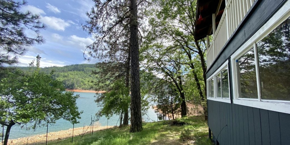
Shoreline accessibility changes dramatically with water level. What might be a gentle, sandy beach in June could turn into a rocky slope by September if levels drop.
Historical Water Levels at Lake Shasta
Lake Shasta has seen dramatic fluctuations over the past decade, with water levels ranging from near-capacity in wet years to alarming lows during multi-year droughts.
Some key benchmarks:
Full Pool Elevation: 1,067 feet above sea level
Dead Pool (lowest usable water level): ~840 feet
Record Low: Approximately 800 feet in 1977
During extreme drought years—such as 2014, 2015, and 2021—the lake dropped to under 30% of capacity, revealing dry banks, old roadbeds, and boat docks stranded far from the waterline.
In contrast, very wet winters, like those in 2017 and 2023, brought Lake Shasta near or even above full pool, prompting flood control releases from the Shasta Dam.
Current Water Level Trends
As of this year, Lake Shasta water levels have shown steady improvement due to strong snowpack accumulation and above-average rainfall. However, the future remains uncertain as climate patterns shift and California braces for drier conditions in some years and flood risks in others.
Monitoring the water level at Lake Shasta has become essential for anyone planning to visit or live near the area. It’s also a key indicator of overall water health for the state.
How to Check Current Lake Shasta Water Levels
Staying informed is easier than ever. Here are a few trusted sources for real-time Lake Shasta water levels:
U.S. Bureau of Reclamation: usbr.gov
California Data Exchange Center (CDEC): Offers graphs, forecasts, and historical data
Local marinas and tourism websites: Often update visitors with water level info and boat launch availability
Bookmark these resources if you're planning a trip or monitoring the lake for fishing or boating.
What Rising or Falling Water Levels Mean for the Local Economy
Lake Shasta is more than just a recreational hotspot—it's the backbone of the local economy. The towns surrounding the lake depend on tourism dollars from houseboat rentals, tackle shops, lakefront lodges, and restaurants.
Low Lake Shasta water levels can mean:
Fewer visitors and cancellations of vacation plans
Marinas forced to close or reduce services
Business losses for fishing guides, tour operators, and retailers
High water levels bring a boost in tourism, often resulting in fully booked hotels and thriving local businesses. In this way, the lake's levels act as a real-time indicator of economic health in the region.
What to Know Before You Visit
If you’re planning a vacation to Lake Shasta, here's what to consider regarding the water level:
Call ahead to marinas, campgrounds, and boat rental companies
Use updated maps if boating—some areas may be unsafe or inaccessible during low water periods
Bring proper gear for changing conditions (life jackets, anchoring gear, portable ramps)
The lake is always beautiful, but your experience will vary depending on conditions—planning makes all the difference.
Conclusion
Whether you're coming to fish, float, or simply take in the view, Lake Shasta offers a stunning escape into Northern California's natural beauty. But staying aware of the water level at Lake Shasta can mean the difference between a flawless getaway and unexpected hiccups.
Water levels impact recreation, safety, travel plans, and the livelihood of local communities. They’re not just numbers—they're vital indicators of California’s ecological and economic health.
Before your next adventure, check the Lake Shasta water levels, plan accordingly, and get ready to enjoy one of the West Coast’s most iconic destinations.